You have received a bunch of DWG files transmitted to you, and you want to quickly convert to a DWF, DWFx, or PDF file for downstream use (perhaps to import to Revizto).

Here is one way, assuming that layouts are uninitialized:

Open AutoCAD

New Sheet Set

Existing Drawings

Give it a name and a home

Browse for sheets and insert them

Open 1 sheet

Create a page setup

Close and Save the DWG

—–

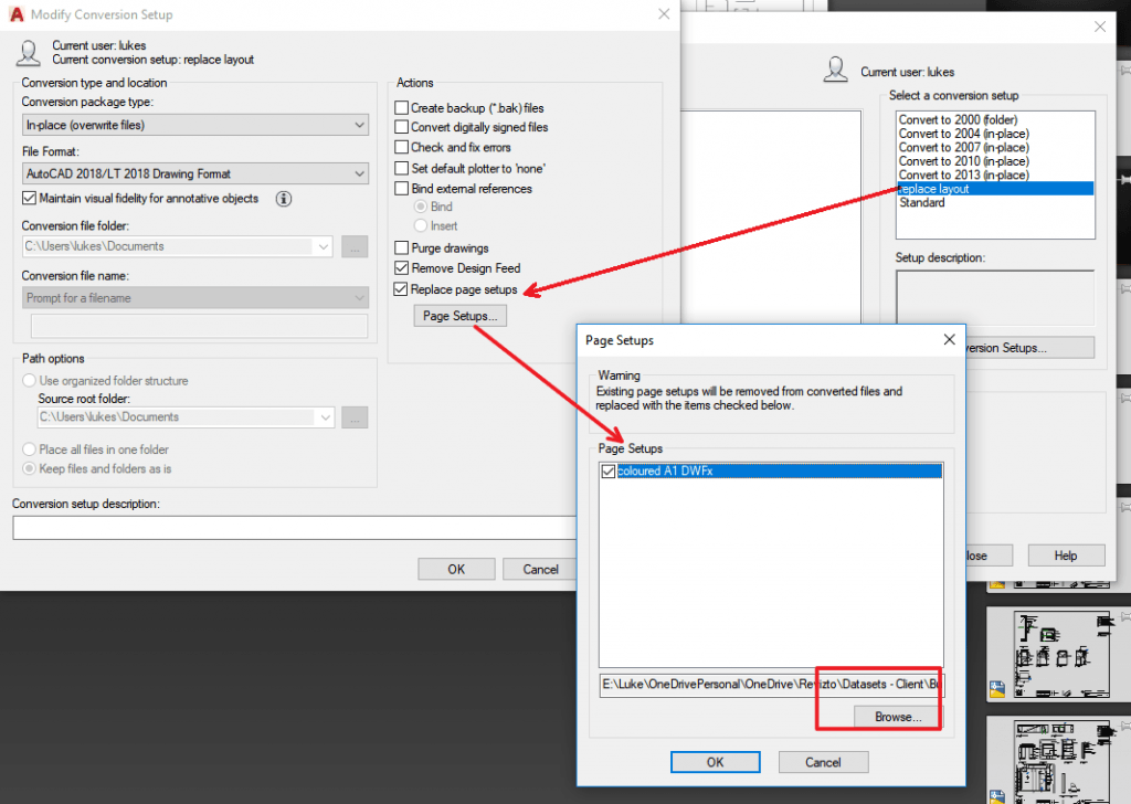
Optionally – Use the DWG Convert tool to ‘replace page setups’ to all sheets. If you don’t do this, you will have to use an Override / Imported Page Setup later in the process.

Type DWGCONVERT and hit Enter, or use Menu

Create a new Conversion Setup

Click ‘Replace page setups’, and load the page setup from the file you created earlier.

Choose other options like “In-place (overwrite files)” and pick same version as those files currently are.

Add files to the Files Tree, then click Convert

—–

Now, you can use the embedded page setup in the Publish Dialog

First, open all sheets in the AutoCAD session

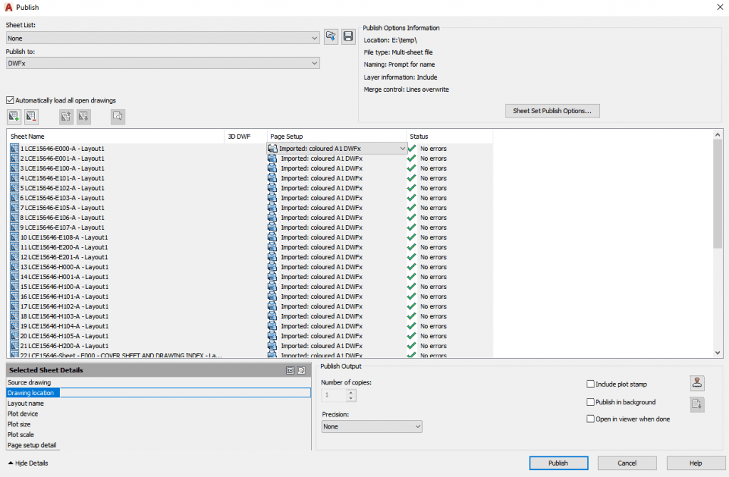
Once opened, go to Publish – Publish Dialog Box …

Choose Publish to: DWFx

Choose All Sheets

Change the Page Setup to the one you created earlier (at this point, you can optionally ‘Import’ the Page Setup if it doesn’t exist in those models)

Click Publish, and give the DWFx a name

You can now use this combined DWFx downstream (for example, you could import to Revizto and overlay to a 3D model).

You could use a similar method to batch convert DWG to DWF, or DWG to PDF.

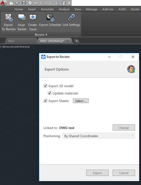
Currently, exporting a flat 2D DWG file from AutoCAD or Navisworks to Revizto will probably yield the following message:

However, you can simply take these steps to work around the issue:

  1. Open the DWG file
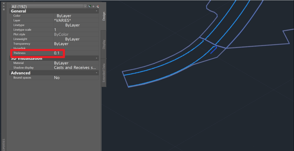
  2. Select all objects
  3. Change the Thickness to something small but non-zero (like 0.1)


  4. Export the model to Revizto (either directly or via Navisworks)

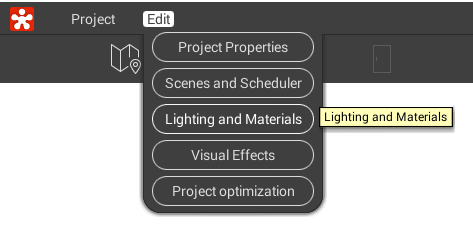
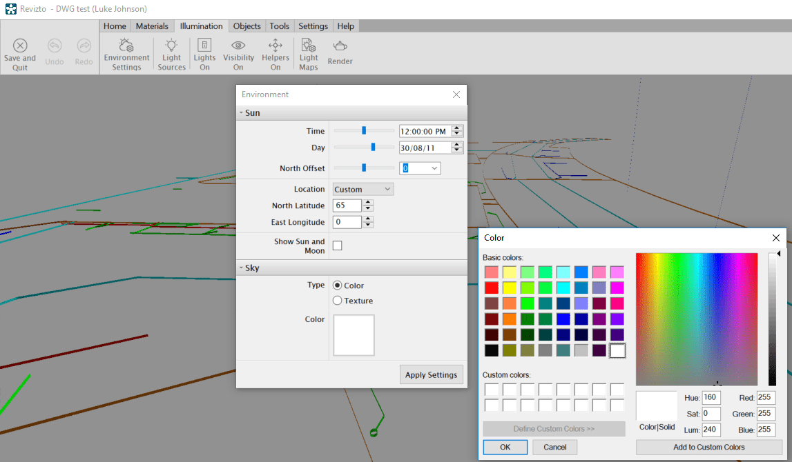
  5. Once in Revizto, you may want to change the background of your Scene to all-white or some solid colour. Just click on Edit -> Lighting and Materials

  6. In the Editor, click on Illumination -> Environment Settings and change the Sky Type to Color

  7. Finally, click Save and Quit

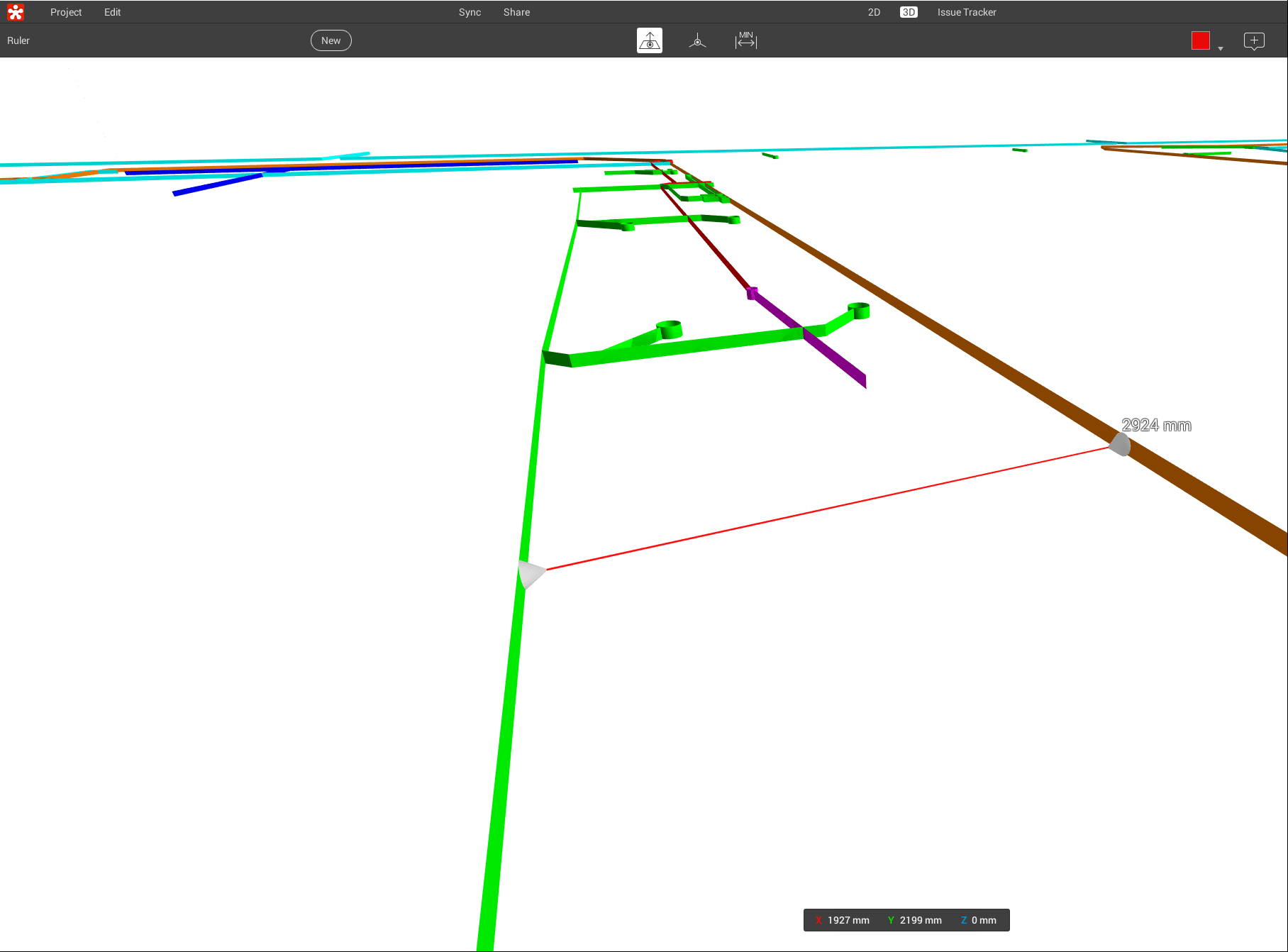
In Revizto Viewer, you can now see your DWG file as thin surfaces where there used to be 2D lines. This also means that you can use the measure tool:

You can use a similar method to the above (change Thickness to non-zero) while using a 2D DWG file, to:

  • export from AutoCAD to Navisworks as ‘3D’ elements
  • export an FBX from AutoCAD as 3D

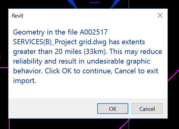
You may have seen the “extents greater than 20 miles (33km)” warning in Revit before:

Geometry in the file dwg has extents greater than 20 miles (33km). This may reduce reliability and result in undesirable graphic behavior. Click OK to continue, Cancel to exit import.
Extents greater than 20 miles (33km)

I have previously posted about ways to clean up DWG files, best and worst practice, and also how Revit deals with accuracy and precision of big models. The short list of steps to take in AutoCAD to clean up a survey DWG is:

  1. PURGE
  2. SCALE all objects to mm instead of metres
  3. WB – write block to a new file
  4. AUDIT
  5. EXPORTTOAUTOCAD (from a vertical product)

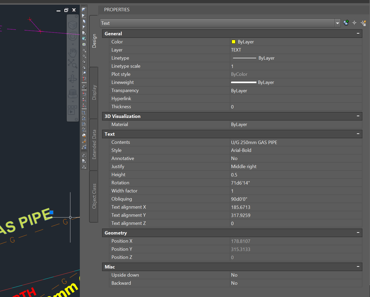
What if, even after all of the usual steps, you still have the ‘extents’ problem? And what if you can’t find the problem in a plan or top view in AutoCAD? That means that you have large Z extents. And you can even have large Z extents from some wayward Text objects with a Z value of like 35000 metres, which will trigger the same message in Revit.

How do we fix these? We need to directly edit the Text Alignment Z in AutoCAD. Here’s how:

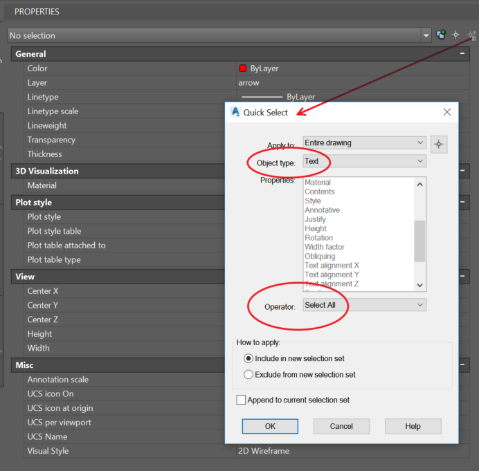
  1. Select All Text with Quick Select tool

  2. Then change the ‘Text alignment Z’ value to 0. This also sets the Position Z to zero.

  3. Then either Save As or use the EXPORTTOAUTOCAD command to remove the proxy objects

Now the DWG should Link to Revit without error. Hope this helps some of you 🙂

If you want to Move Text to the Elevation corresponding with the text value, such as for a Civil elevation, you can use this command. With a Civil or other vertical product, start the special command:

  1. _AECCMOVETEXTTOELEVATION
  2. At the ‘Select text objects’ prompt, type All and hit Enter
  3. The text should have been moved automatically

Forum link

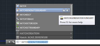
You can use HATCHGENERATEBOUNDARY in AutoCAD to recreate the boundary of a Filled Region that you exported to DWG.

You may be asking “why!” Well, if you have a bunch of Filled Regions and their sketch lines are all set to Invisible Lines, this may be one of the quickest ways to get a visible, printable outline of those filled regions in Revit

Here’s a quick video:

https://screencast.autodesk.com/main/details/6760f260-29f9-4690-890b-2516ac507f24

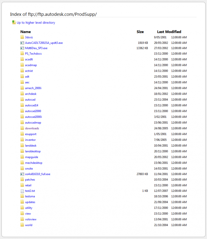
If you are struggling to find updates, hotfixes, patches and other resources for older Autodesk software, try this page:

ftp://ftp.autodesk.com/ProdSupp/

There is a lot in here:

This is one of the most prolific folders, containing files from about 1998 to 2005:

ftp://ftp.autodesk.com/ProdSupp/downloads/

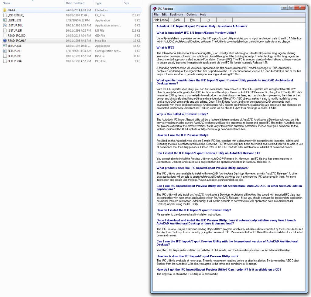
And what is IFC doing in here?

Pretty cool that Autodesk were supporting IFC 1.5 in 1998:

via
� Autodesks FTP Product Support Download Page Tech Solutions

While the free Labs Point Cloud Feature Extraction for Revit 2012 is very hard to find these days, there is a version of this tool available for AutoCAD:
Point Cloud Feature Extraction | AutoCAD | Autodesk Exchange Apps

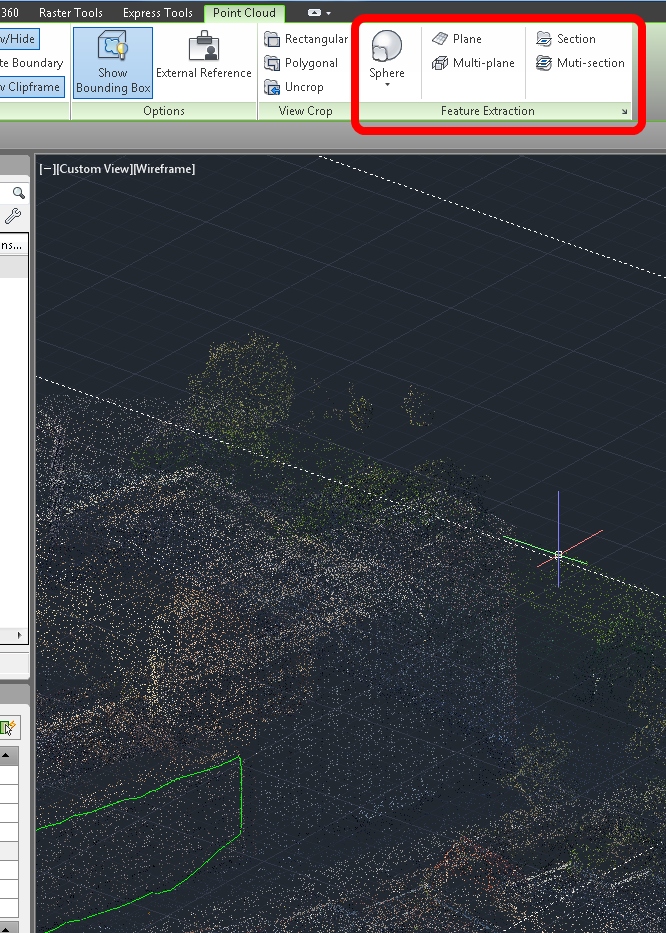
Use this plug-in to create geometry and primitive shapes that align with the features of the point cloud. To help isolate the shapes, planes, and sections you want to extract, you can crop, or hide, one or more areas of the point cloud.

EDIT  It looks like this in AutoCAD 2014:

Just import a point cloud, select it, and the tools become visible in the Ribbon.

A very interesting Case Study written by Doug Andresen (principal architect at Andresen Architecture, Inc) was posted to AUGI last week.  He describes how his firm transitioned from AutoCAD to Revit.

Here are a few quotes I liked:
we purchased the product and only used Revit for renderings for the first 3 to 4 years. We were so pleased with just that portion of the program that it was fine with us to sell a project with colored renderings and continue to deliver the project in AutoCad. However, the beauty of Revit is its seamless integration from preliminaries to construction documents and the time savings are phenomenal.

the more experienced people in AutoCad seemed to have the hardest time learning Revit because it was such a different paradigm and it took a great deal of effort to re-learn everything.  
[Different paradigm?  Its called What Revit Wants]

the set-up time is significant and not for the faint-of-heart. What we finally ended up doing is simply taking the plunge into construction documents after completing the Revit tutorial.

We had to install an in-house “virtual cloud” that would run up to 5 seats simultaneously

all of the good things you have heard are all true! Don’t be afraid of the challenges that the program presents. Revit is the future and the sooner you get on-board, the better.

Read the whole article:
Industry Spotlight: The Revit Revolution | AUGI

Some wisdoms from Paul Aubin:
BIM isn’t a particular product, but rather a description of the process and intent of the deliverables used to describe, construct, and even maintain a facility. It’s therefore possible to deliver BIM with any tool, even AutoCAD.

The hardest part of the transition from AutoCAD to Revit is not the learning of the new tools and interface, but rather the “unlearning” of AutoCAD approaches and replacing the thought process used to approach a building design project with the corresponding Revit-based workflow.

In other words (dare I say it), you need to learn What Revit Wants

Read the whole post:
How to approach migrating from AutoCAD to Revit | lynda.com | lynda.blog

Coming from an AutoCAD background, it comes as second nature to me to draft bounds (boundaries) in AutoCAD.  Set your Units to Deg/Min/Sec, set north to 0 degrees and use Clockwise, then start typing and use the @ symbol to start the new line at the current location.  Its logical and reliable.  In Australia, we generally have all our survey reduced to that form – 0 degrees for North, then Clockwise bearings related to that.

Here is my experience with using Revit Property Lines as they were intended (?) to be used…

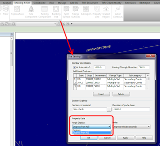
First step is to enable the Degrees from N/S setting in your Site Settings:

Then, go to a Plan View and set it to True North.  Start the Property Line tool and select Create by Entering Distances and Bearings.

Ok, basically you enter the length, the angle, and choose either N/S and E/W.  That’s it.  But what settings should you choose?

You always need to reduce your bearing dimension to something between 0 and 90 degrees (the dialog will not accept anything outside of this).  You can do this using a formula, like:

=180-140° 00′ 35″

Then you use the N/S and E/W switch to mirror or flip the dimension bearing.  In some cases, it is easier just to hit OK and see which way it is heading, then switch between the N/S and E/W settings till it looks right.  If it still doesn’t work, you may need to orient it inversely against 90 degrees, by doing something like:

=90-0° 44′ 10″

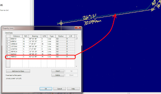
Let’s do an example.  Here is the Property Line segment we want to make:

We can’t use 261 degrees, so we use a formula to minus 180 from that angle.  Then, as my previous line was using S and W, I set those to the new line.  It works!  Here is what it looks like:

You can see that my line is slightly off the background image – this will be fixed once the whole boundary has been input (it can be moved at that point).

To reduce the above unit entry process into a simple step-by-step:

  1. Using an inplace formula, subtract 90,180 or 270 from the bearing to make it less than 90.
  2. Choose a quadrant into which the line will protrude from a given starting point -NE,SE,SW,NW
  3. If the line still does not match, subtract the bearing from 90 to correct it (flip within the target quadrant).

Good things about Revit Property Lines based on tables:

  • You can quickly check the data
  • Data can be changed relatively easily
  • Closing line can be added

Bad things:

  • Can be slow and repetitive

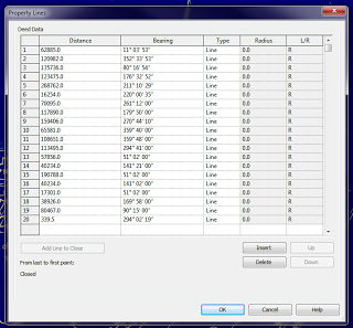
Interestingly, once you have created your Property Line, you can turn off the NS/EW setting in Site Settings, and when you Edit the Table, it will show all boundaries related to True North:

Further reading:
Property Lines by Distances & Bearings missing N/S and E/W – The Revit Clinic

Revit Architecture 2010 User’s Guide: Creating Property Lines with Survey Data

RevitCity.com | Property Lines