Aerial imagery and 3D models are extremely powerful visual tools. Often, these are used primarily in early design and master planning. Some software tools connect directly to aerial imagery and 3D data providers. Unfortunately, Google has not really opened up the connection to their base 3D data. But we can capture imagery from it, and then rebuild in another photo-to-mesh tool, like Recap Photo. Keep in mind that you will be creating a 3D mesh, from an isometric 3D world view, which was created only from aerial images. Basically, your output will vary, and will probably not be high quality. But for the intended use in early design and master planning, the below workflow may be useful…

Note: Please investigate the license and copyright of this data for such use.

Here’s how:

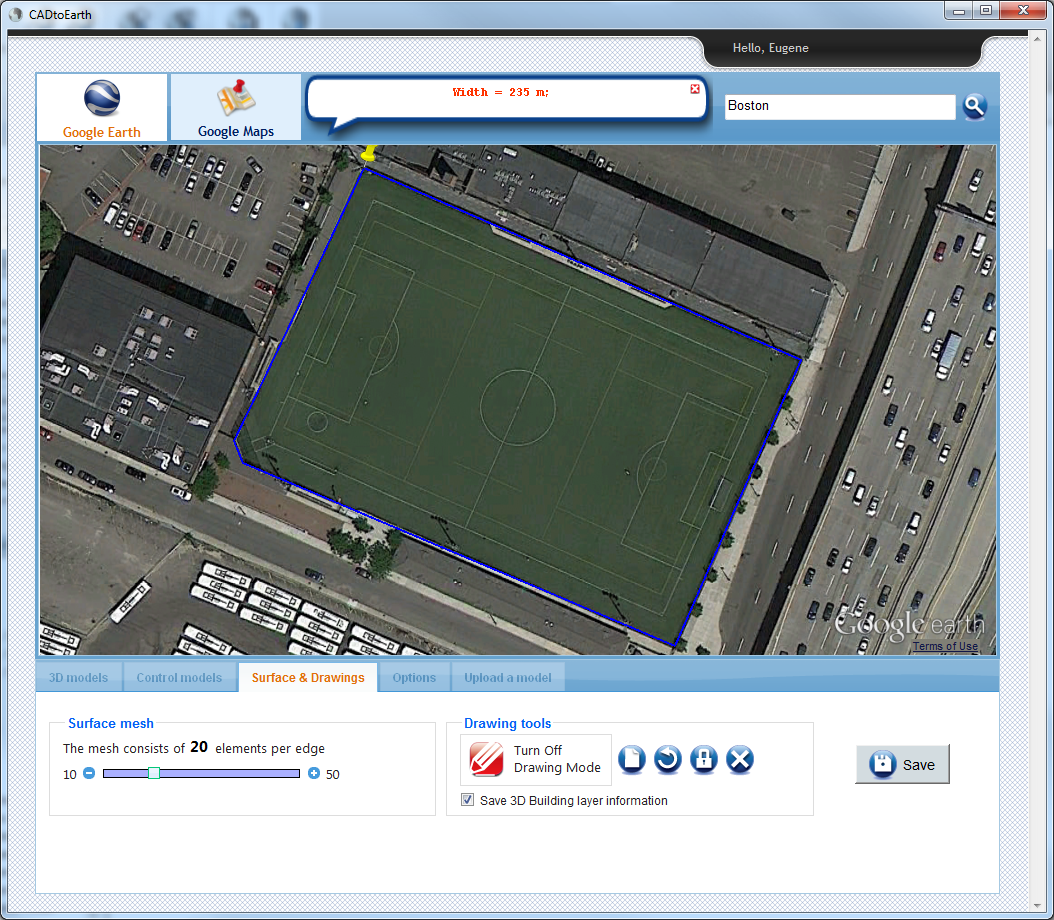
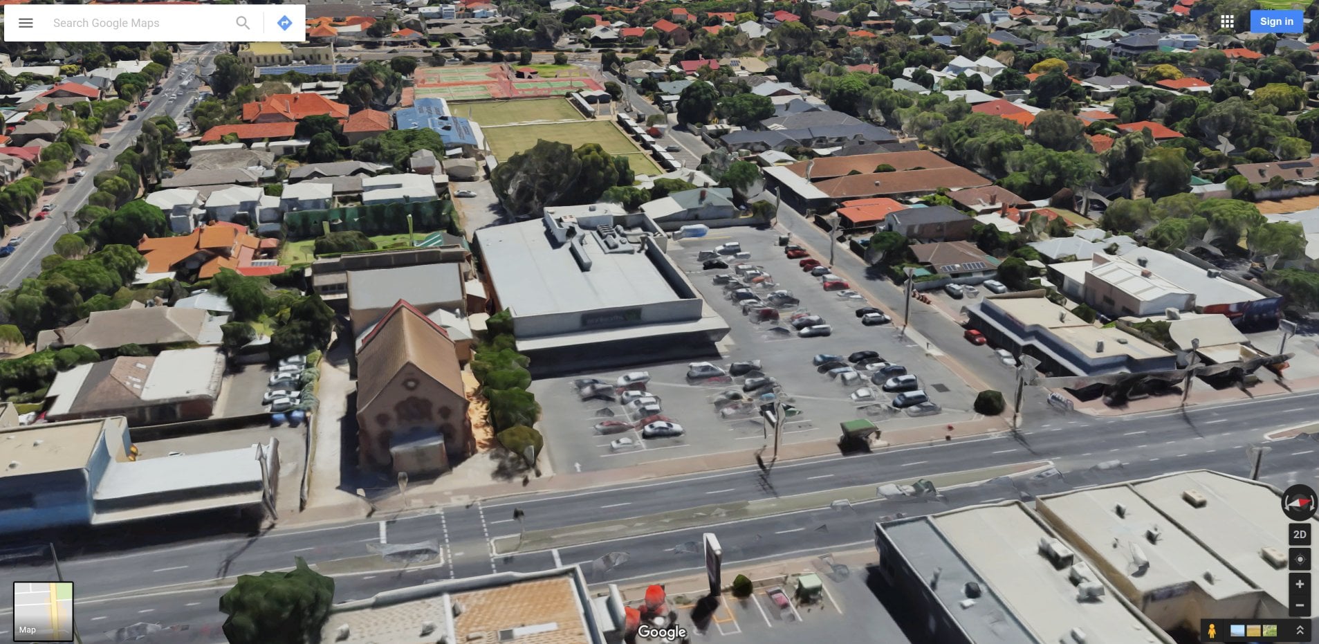
  1. Open your desired 3D isometric aerial imagery in desired application (such as Google Earth, Google Maps or similar)

    *Note: User to be aware of relevant copyright restrictions
  2. Open ScreenToGif (downloads here). This is used to create snapshot images of the screen very quickly.
  3. Setup the scene, so that you have the ScreenToGif window appropriately overlaid onto your actual imagery
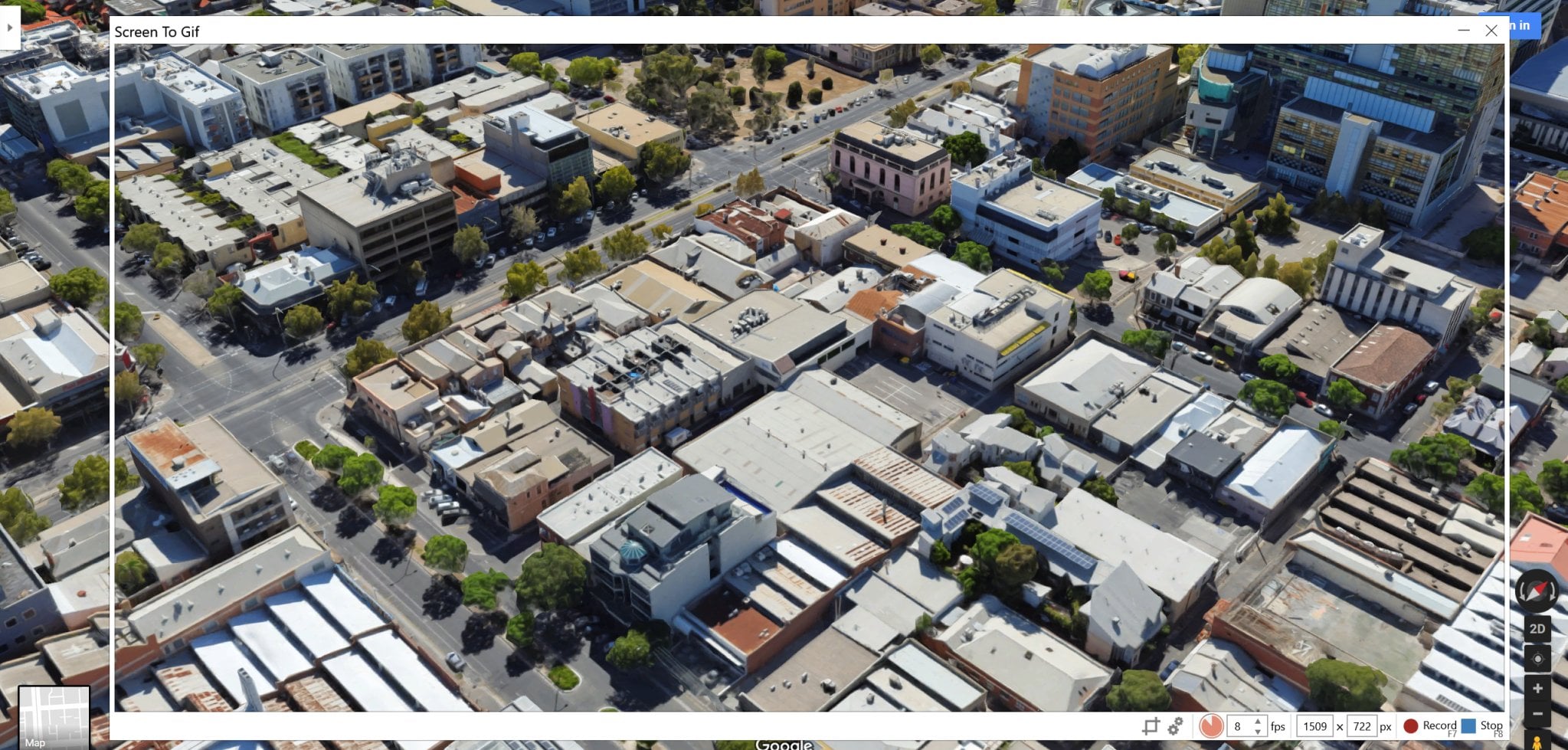
  4. Start recording, and slowly orbit at least 360 degrees as shown
    here
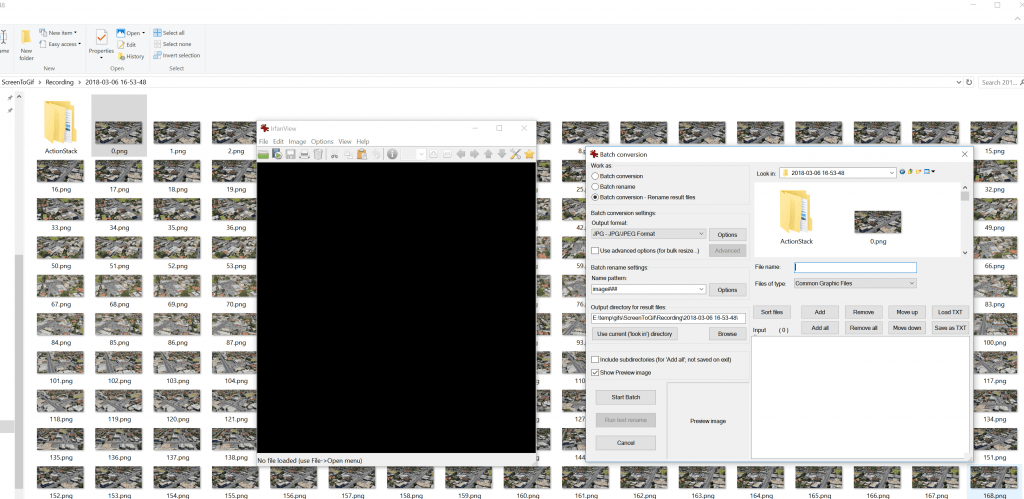
  5. In ScreenToGif, open the image folder
  6. Convert the images from PNG to JPG (I used Irfanview Batch Convert)
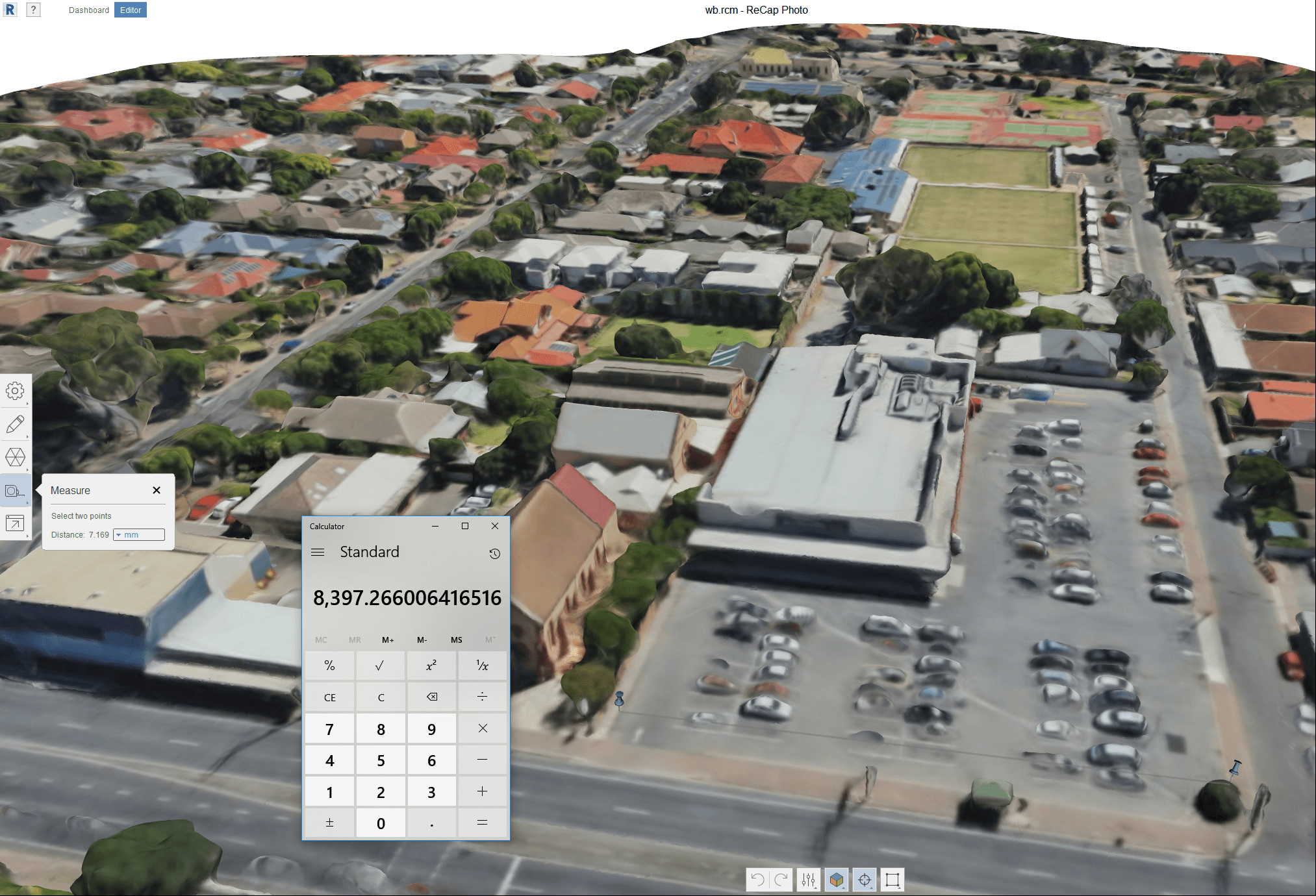
  7. Load into Recap Photo, make new Object project, spend 12 cloud credits and start the mesh creation
  8. After meshing, in Recap use the measurement scale tool to scale the model based on the distance between two known points

  9. Export the 3D Model from Recap. Various formats are available. In this case, I exported directly to FBX with Y-Up and imported straight to Revizto. You could also import FBX to AutoCAD and then to Revit, or you could bring it into Meshmixer first to delete some parts of the model via OBJ.

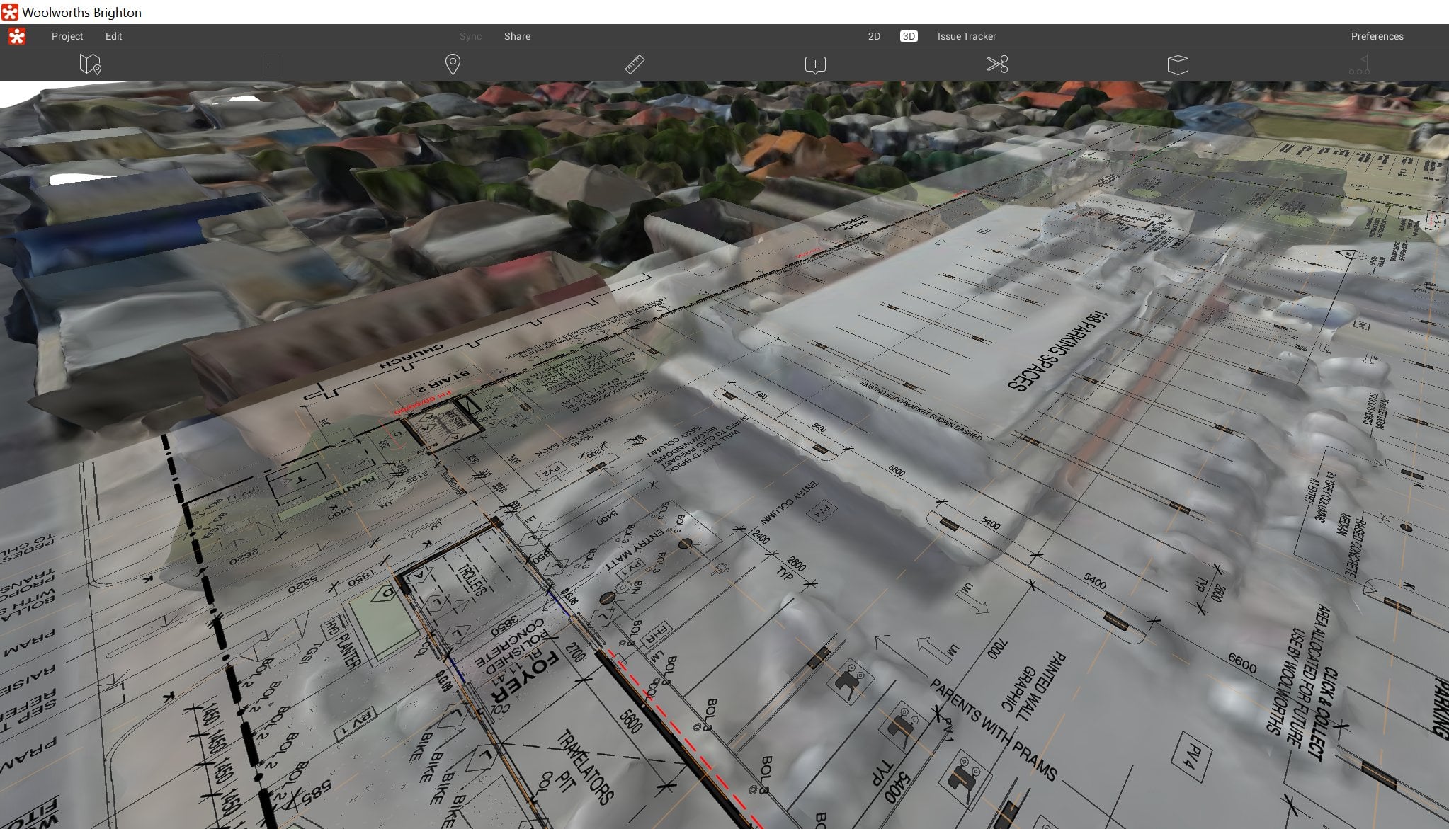
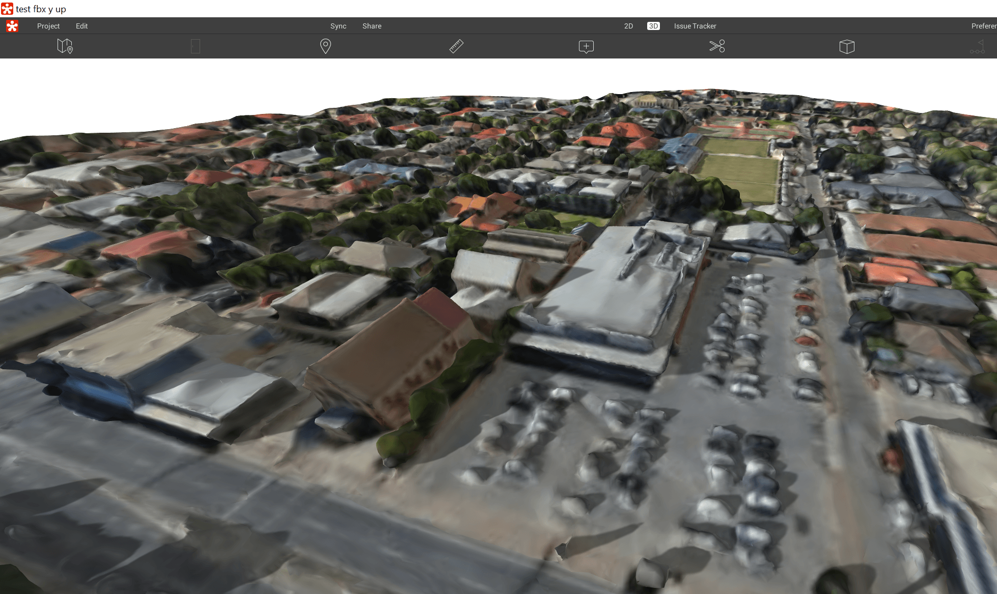
In Revizto, the direct FBX import looks like this:

Sheet overlay in Revizto. Simply with a PDF and some freely available aerial imagery, we now have a 3D collaboration workspace ready to go:

Most of you probably know that you can use a Decal in a 3D view set to Realistic for 3D masterplanning.  The annoying part is that you have to somehow scale the Decal properly.

You may also know that Vasari has a nice built-in method of grabbing Google Earth imagery and unlike Revit, Vasari is happy to show this image in 3D views.

Now, Philip Chan has combined these two methods to make a decent workflow for Revit:

  1. Grab the image in Vasari first
  2. Open that Vasari file in Revit
  3. Import the same image from Vasari into Revit as a Decal and place it on a flat workplane
  4. Use the “borders” of the Vasari image to properly scale the Revit decal
Its a bit fiddly, but until Revit supports images in 3D views, it will have to do.  Or, you could convert the image to a DWG and use that (I’m mostly kidding).

In Philip’s words:
use a trick to get it scale properly. I actually used the Vasari file that I made earlier, I drew some model lines at the boundary of the image, copy the model lines to the clipboard, and then paste them into my site file. Now that I had the actual size of the boundary, I could use the same image export from Vasari and placed it as a decal.

Read the whole post:

I previously posted about CADtoEarth at:
https://wrw.is/2012/08/quickly-add-google-earth-site-context.html

Although some people have struggled to implement it or understand how it works, I still like it as a quick way to import Google Earth topography as site context.  The new version is on Exchange at:
http://apps.exchange.autodesk.com/RVT/en/Detail/Index?id=appstore.exchange.autodesk.com%3acadtoearth%3aen

Video:

via email:
We, at AMC Bridge LLC, are excited to announce availability of new version of CADtoEarth for Revit the application that allows for seamless integration between Revit and Google Earth.

The CADtoEarth 2.0 add-in now allows users to create personal accounts on the CADtoEarth web application and provides individual control over the visibility of uploaded data.

We continue improving our applications, so please, dont hesitate to contact us at contact@amcbridge.com if you encounter any problems with the new version, or have any enhancement requests.

How to use

  1. Download and install the latest, free Google Earth applicationExternal link icon. Existing Google Earth users should ensure they have updated to the latest version (version 7.0.2 or newer).
  2. Save the qldglobe.kml file to your computer and double click on the file.

Some notes:
The default imagery used in Queensland Globe is the best available to the Queensland Government that can be released for public viewing.

All layers have been pre-set to only display between certain scales, i.e. more detailed layers will only display at larger scales (you may need to zoom in to see them).


new mapping images showing the entrance to the Clem-7 tunnel at Bowen Hills
 

High resolution aerial photography flown between August and December 2012 has recently been added for Brisbane, Ipswich, Moreton, Mackay, Redlands and the Sunshine Coast.

Main page:
http://www.nrm.qld.gov.au/mapping/queensland-globe.html

Google Earth 6.2 features a new way of rendering all those mosaic pics of satellite and aerial photographs, smoothing out the borders between them so the globe looks even more like our beautiful blue planet.
That smooth beauty is not just visible from a distance, either — as you zoom in, the seamless look continues, all the way down to the closest views.

If you haven’t used Google Earth in a while, download Google Earth 6.2 and look at how much better it’s become.

via
Google Earth 6.2 Is a Massive Improvement, Shows Smooth Blue Planet [PICS]

Navigate to where you want to be and get as close as you can.

Start to create a placemark by clicking the pushpin icon.

In the placemark’s dialog box, click the “View” tab.

Change the number in the “Range” field to 500m.

Then believe it or not, click “Cancel” and you will see yourself zoom out to 500 meters altitude.

Google Earth’s placemark dialog box has the range setting in meters regardless of whether you have feet or meters set as your default in Tools –> Options. If you wanted exactly 500 feet, you would need to convert to meters and enter the meters value in the Range field.

via Appletom post at
How to Set Altitude in Google Earth

With regard to the datum of measurement for altitude, this statement from the above thread may be helpful:
Summary – when terrain is on, Google Earth’s eye altitude represents ASL (Above Sea Level). When terrain is off, Google Earth’s eye altitude represents AGL (Above Ground Level).

You can turn terrain on and off in Tools – Options.

There are actually 5 different ways that Google Earth measures altitude:
Clamped to ground
Clamped to sea floor
Relative to ground
Relative to sea floor
Absolute

For more information on these, check out the post at this link.