Interesting – this kind of turns the point cloud technology upside down… It goes something like this:
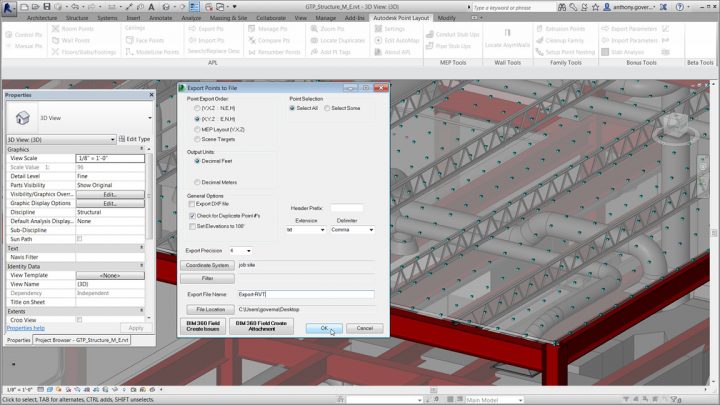
- Revit model
- to points
- to site survey hardware (set out the building)
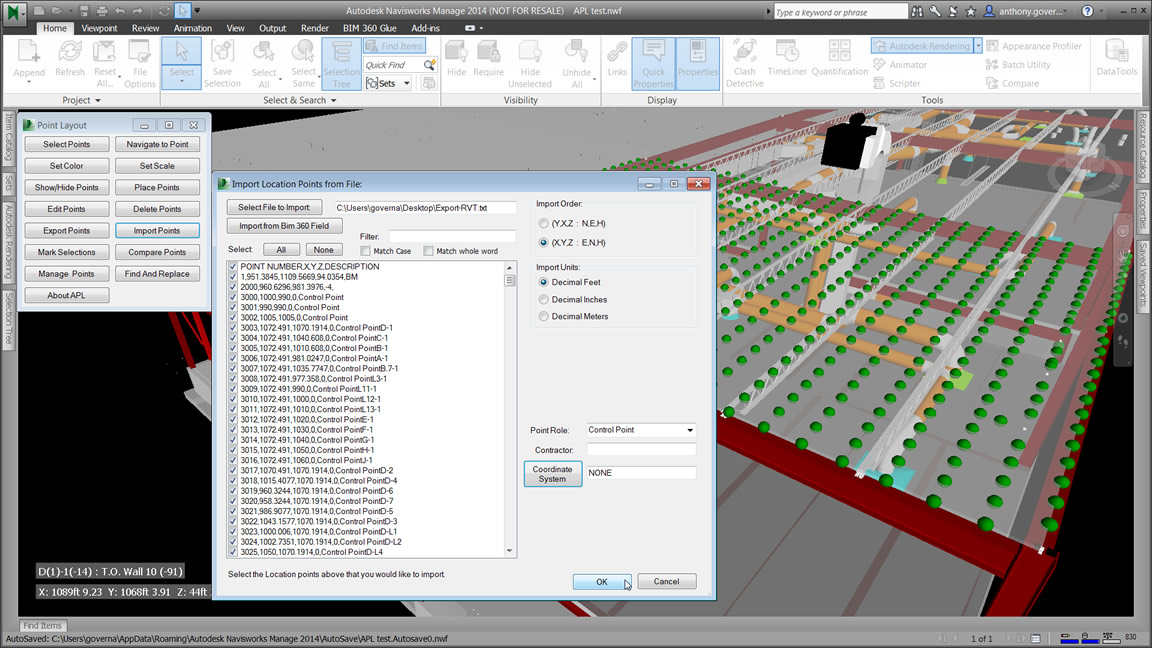
- build it
- then laser scan the as constructed
- compare points of the as built model for quality control

The part I’m trying to get my head around is this – these aren’t really point clouds, but rather, they are setout points of Revit BIM 3D elements for construction use. Perhaps the word ‘point’ is going to be more popular than the word ‘BIM’ this year 🙂
Learn more / trial at:
Point Layout | Construction Layout Software | Autodesk