It is extremely easy to reduce the size of a point cloud dataset using Recap. “Decimation” is the process of discarding points from the data to improve performance and reduce disk usage.

With the release of point cloud support in Revizto, you can now bring a point cloud into the Revizto platform in a number of ways:

  • Export from Navisworks
  • Export from Revit
  • Import points directly in RCP or RCS format

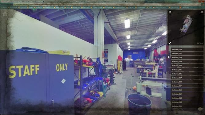
Once the reality capture model has been added to Revizto, you sync it to the cloud. From there, you can download and view the point cloud on your iPad, and of course you can start creating issues that relate to the captured condition on site. You can even overlay 2D drawings onto the reality capture data.

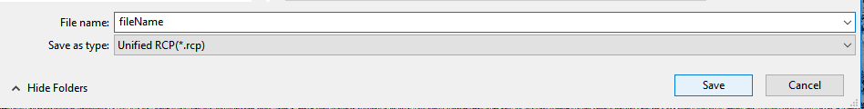
The decimation process is very easy :

  1. Open your Recap file (add scans and index first if necessary)
  2. Click Export
  3. Give your file a name

  4. Click the settings button
  5. Move the slider to adjust your point decimation – you might use around 50mm decimation for a lot of site applications.

  6. Save the file

There are other considerations, such as:

  • How can you set up coordinate systems to work with Revit, Navisworks and Revizto?

These will be considered in more detail in another post.

Going back in time, there was 123D Catch and related processing engines. Basically, it was a tool that took photos and turned them into something real in 3D. There was also something called Remake.

Now, we have Recap Photo, which basically does the same things. Over time, the processing engines have improved. Recap Photo is part of your Recap Pro licence, and now integrated into your Recap Pro install. It looks something like this when you install the latest version of Recap (I downloaded the web installer from manage.autodesk.com):

Once installed, you can start the standalone ReCap Photo app:


Features of ReCap Photo include:

  • A new photogrammetry engine that can process up to 1,000 photos, a 4x improvement from the previous maximum of 250 photos (note: using the cloud service consumes Autodesk Cloud Credits)
  • The ability to set GPCs (Ground Control Points, survey points) in any coordinate system.
  • New functionality to support vertical and nadir photos (photos taken by drones and UAVs at 90 degrees above the site)
  • View your 3D photo-textured mesh
  • View the geolocated orthographic view, zoom in and out, and add measurements, tags, and annotations.
  • Share the project, including its additional metadata (measurements, tags, annotations), with anyone.
  • Merge laser scan point clouds with UAV-based point clouds.

From this post http://blogs.autodesk.com/recap/introducing-recap-photo/

To get a Free trial of Autodesk ReCap Pro click on the following link: ReCap Free Trial

You can use Autodesk ReCap 360 now for free if you have a Autodesk 360 account. If you don’t have an account, you can sign up for free by clicking on the following link: Autodesk ReCap 360

Read more:
http://www.cadlinecommunity.co.uk/Blogs/Blog.aspx?ScoId=f542a2ef-8a1f-4223-af91-6d52aea299b0